
Walk a Hurricane Street Record
Begin with the full street number and spelling. The public trail moves from a physical location to a parcel, from that parcel to an owner, and from the owner to recorded instruments. That sequence keeps a Hurricane street directory result tied to documents instead of guesses. It also helps when a road suffix, mailing city, or older place name differs across sources.
- Select Putnam County in the state property search, then enter part of the physical street address.
- Open the parcel in MapWV, confirm its E-911 address, and record the full parcel ID and legal description.
- Compare the owner with the separate mailing address, without treating either field as an occupant list.
- Search the Putnam County Clerk deed index for the owner as grantee, then follow the prior grantor backward.
- Use the county voter-file request for lawful street work and regional criss-cross books for historical occupants.
A parcel result proves an assessment record, not who was home on a given day. A voter row confirms a registration record subject to state limits. A directory entry is a dated publication. Match two sources before attaching a name to a Hurricane address.
Search Hurricane Streets in MapWV
The West Virginia Property Assessment search is the strongest online start for this street directory. Choose Putnam County before using dependent fields. Street Name accepts any part of the physical address. Owner Name, Full Parcel ID, Mailing Address, Deed Book, Page, and Legal Description offer other routes. Basic, Appraisal/Sales, Advanced, and Prior Ownership modes separate common searches from deeper filters.
| Portal field | Input | Street use |
|---|---|---|
| County | 40-Putnam | Activates local fields |
| Street Name | Part of physical address | Finds matching situs records |
| Owner Name | Whole or partial name | Checks ownership |
| Full Parcel ID | County-District-Map-Parcel-Suffix | Targets one parcel |
| Mailing Address | Advanced text | Finds tax correspondence |
| Legal Description | Advanced text | Bridges changed numbers |
The captured official assessment interface shows why county selection comes first.
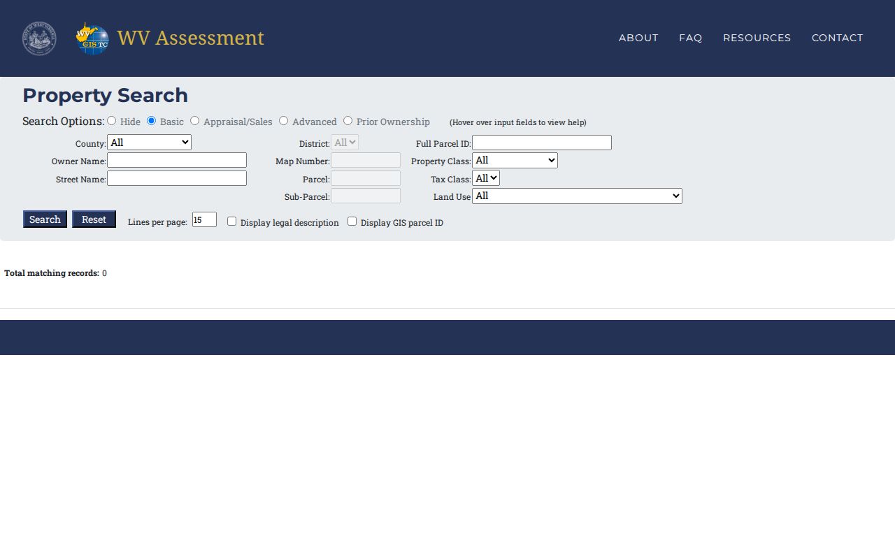
The screen provides a repeatable route from a street phrase to a parcel record. Date the result and ask the Putnam County Assessor about errors.
Hurricane Address Fields Differ
Three address forms may sit beside one another. The situs or physical address says where the parcel lies. The mailing address says where tax correspondence goes. The legal description identifies land through a subdivision, lot and block, or metes-and-bounds based on bearings and landmarks. One is not a substitute for another.
- Parcel
- A mapped unit of land identified for assessment.
- Situs address
- The physical location assigned to the parcel, often through E-911.
- Plat
- A recorded map of lots, blocks, boundaries, or a subdivision.
- Criss-cross directory
- A dated book arranged by street and number instead of only surname.
A Hurricane owner may receive mail elsewhere. An old deed may lack today's number. Copy the parcel ID and legal description before moving into deed books. Those identifiers are safer than assuming the tax-mailing line proves residence.
Note: The Sheriff uses a July 1 ownership snapshot for the next tax year, so a later sale may not appear at once.
Browse Hurricane Parcels by Street
The WV Property Viewer turns an address result into geography. Controls include Search, Layers, Basemap, Tools, Clear, and Help. Parcel boundaries appear at close zoom. Address, Parcel, and Flood Zone layers can be shown. A selected polygon offers Zoom, Details, Toggle Highlight, and Copy Link, which helps when asking the assessor about one exact site.
MapWV accepts an E-911 street address with city and state, not a rural route or post-office box. Parcel search can use county plus parcel number, owner, or property address. A result may show community, physical address, owner, description, building information, appraised values, flood information, and an assessment link. These are parcel fields, not a household roster.
Open the official parcel viewer to see the mapping surface.
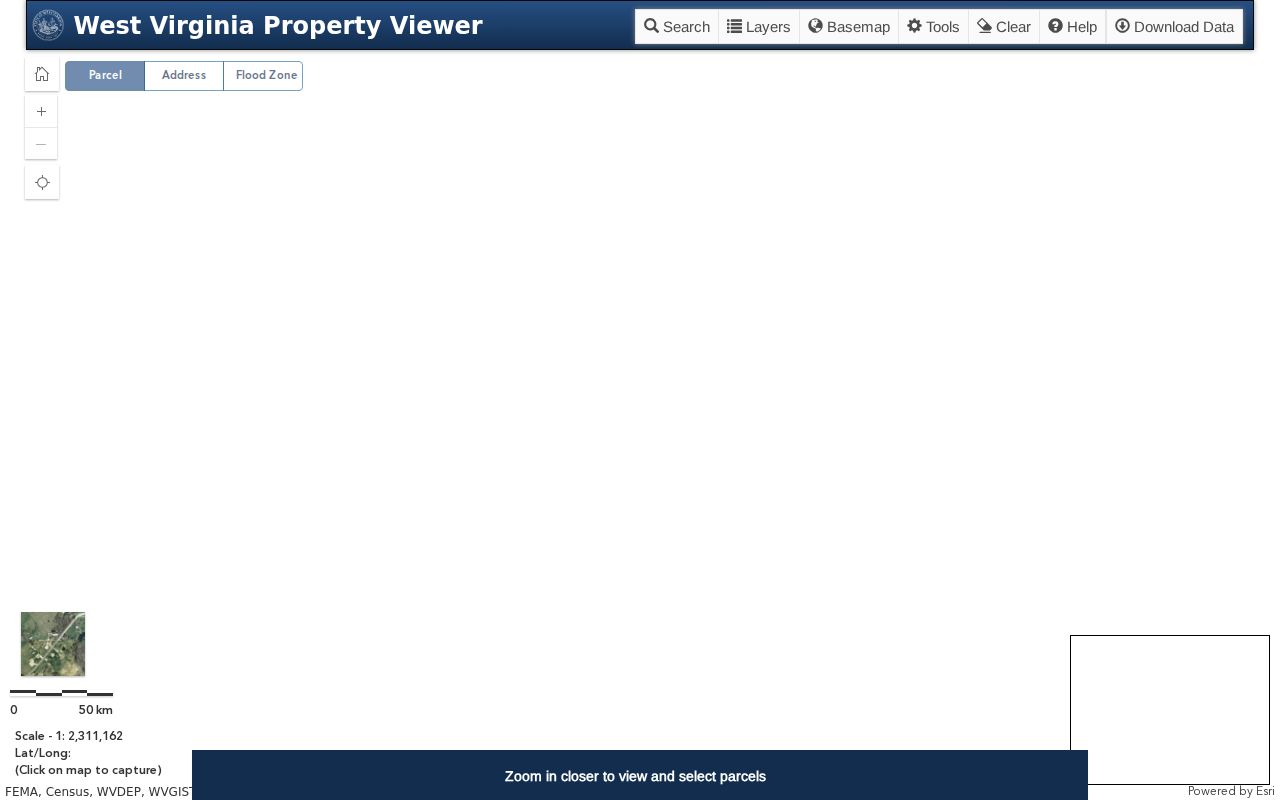
Use the map to confirm shapes and neighboring lots, then return to recorded documents for ownership history. It has no radius search for people.
Hurricane Records Keyed by Address
No single Hurricane street directory has complete reach. Know which custodian owns each layer and whether access is online, requested, or in person.
| Address record | Keeper | Evidence | Access |
|---|---|---|---|
| Assessment | Putnam Assessor | Owner, situs, mail, parcel, values | Portal; office follow-up |
| Parcel map | MapWV | Geometry, E-911 address, report link | Free viewer |
| Deeds and plats | County Clerk | Parties, legal description, book/page | RECORDhub; counter; Archives |
| Voter file | County Clerk | Name, residence, party, status | Inspection, terminal, request |
| City permits | Hurricane Building | Project address, owner, scope | City request; no public index found |
When the web path fails, contact the custodian. The Putnam Assessor handles parcel issues at 304-586-0206. The County Clerk explains deed images, old books, and portal coverage at 304-586-0202. County offices are in Winfield.
Trace Hurricane Street Ownership
The Putnam RECORDhub portal is the doorway for deeds, deeds of trust, liens, releases, rights of way, plats, judgments, and other instruments. Begin with the current owner as grantee, the buyer or recipient, near the purchase date. The seller is the grantor. Search that seller as an earlier grantee and repeat.
Record document type, date, book and page or instrument number, parties, legal description, and parcel reference. An index hit describes a filing. It is not the same as opening the image or getting a certified copy. RECORDhub did not state its online start date or image price during research, so a blank web query cannot close the trail.
The RECORDhub search-site selector shows how a user reaches a participating county before opening its land-record index.
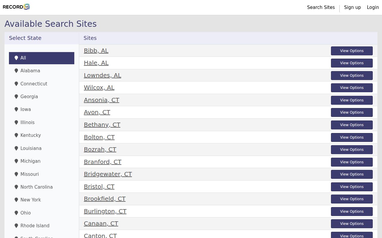
Select Putnam rather than treating a statewide shell as one combined deed index. The county choice controls the source and its available records.
The Putnam portal screen is also preserved in the official county entry point.
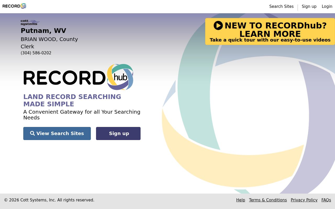
This page confirms the online doorway, but it does not publish a reliable historical cutoff. Ask the Clerk before calling a web search complete.
The WV State Archives Putnam holdings list deeds from 1848 through 1900 and a deed index from 1848 through 1968. Ask for the cited volume or call the Clerk when the portal ends. A written request should state the parties, approximate date, address or legal description, desired book and page, and whether an ordinary or certified copy is needed.
Date Hurricane Changes by Address
A permit can date work without naming every user of a parcel. The Hurricane Building Department handles city projects. Putnam Planning and Infrastructure handles applicable unincorporated work. This split matters near city edges. A missing county record may mean the city was the proper custodian.
The city form asks for project address, owner, applicant, contractor, work type, dimensions, value, and description. No public Hurricane permit index was located, so make a focused request with the exact address, parcel description, and date range. Under West Virginia FOIA, a reasonably specific request generally gets a response within five days, excluding weekends and legal holidays. Actual reproduction cost may be charged, but not search time.
Permit evidence belongs beside deeds and old directories. It can date an addition or demolition, but it does not prove occupancy.
Hurricane Voters by Street
The public online voter tool does not search by street. It needs first name, last name, and birth date, then may return status, party, districts, and polling place. A street directory project needs the statutory voter-file route through the County Clerk.
Under West Virginia Code §3-2-30, active, inactive, rejected, and canceled records may be inspected in office hours. They may appear on a read-only terminal or be furnished in available formats for noncommercial use. Public elements can include name, residence address, party, and status. Phone, email, Social Security number, driver's-license number, and nonoperator ID are excluded.
Ask about formats, sorting, preparation time, and lawful address options. Never scrape the small confirmation tool or assume a voter list names all Hurricane residents. Status changes and protected records are redacted.
Old Hurricane Streets Need Names
Historical address work must account for Hurricane's names. The settlement appeared as Hurricane Bridge, shifted with the railroad in 1873 to Hurricane Station, and incorporated in 1888. A newspaper, gazetteer, or directory may use any form. Do not add modern postal language to an older record.
No official street-renumbering schedule, grid diagram, or annexation conversion table was found. When a number changes, use subdivision, lot, block, parcel ID, deed citation, creek, road, or landmark. Plats, E-911 staff, council minutes, and the Hurricane Breeze may fill a gap. The Hurricane city directory collections explain the historical shelf in depth.
The Asbury House nomination models this method by connecting a Hurricane property to Corbly Addition lots 7 and 8, Block 1, and Deed Book 354, page 740. Legal description carries the chain when street labels fail.
Limits of Hurricane Street Records
Public ownership does not equal present occupancy. The assessor describes a parcel and owner. Deeds show recorded interests. Permits document work. Voter files cover registrants under state rules. None names every adult, child, guest, utility customer, or mail recipient at a Hurricane address.
Lawful use. Use Hurricane address records only for lawful personal research, and never to stalk, harass, threaten, or harm any person.
West Virginia's Address Confidentiality Program gives a substitute address and mail forwarding to qualifying survivors for four years. Other records may be sealed, redacted, delayed, or wrong. Even a strong by-street result needs a source date and label such as owner, registrant, permit applicant, or historical entry.
Utility and delivery records are not a public household index. A protected voter may be absent from an address-based file, and a sealed case cannot be reconstructed from other clues. When a portal returns nothing, check spelling, county, date, and access limits before calling it a non-match. The same care applies to commercial neighbor tools. Their mixed data may lag behind the official parcel or recorded deed and should never replace custodian evidence.
The best street directory is a documented chain, not a claim about every home. Preserve the exact query, access date, parcel ID, and citation. Confirm disputed facts with the custodian.