
Sources for Hurricane Neighbors
A block search works best when each source answers one narrow question. MapWV establishes which parcels share a line or sit across the road. The assessment roll identifies the recorded owner and parcel facts. A requested voter file can show some registered people by residence address, but the public web lookup cannot list a block. Civic groups offer contact routes rather than household rosters.
| Hurricane source | Block-level evidence | How to reach it |
|---|---|---|
| WV Property Viewer | Parcel polygons, physical address points, flood layer, owner or assessment link | Free statewide MapWV viewer |
| WV Property Assessment | Owner, mailing and situs addresses, parcel ID, legal description, values | Free search after selecting Putnam County |
| Putnam voter file | Available name, residence, party, status, precinct and voting fields | Inspect or request under W. Va. Code §3-2-30 |
| Hurricane Neighborhood Watch | A city safety-program lead, not a published roster or neighborhood map | City police page and non-emergency line |
| Library and civic contacts | Local-history referrals, organization names, minutes, and public notices | Hurricane branch, city records, or current group contact |
Ownership is public evidence about land, not a household census. The tax-mailing address may belong to an owner elsewhere. A voter entry is a registration record with legal limits, not proof that every person at an address is listed. Keep those distinctions visible when identifying people nearby.
Map Hurricane Neighbors by Parcel
Open the WV Property Viewer and search an E-911 street address with street, city, and state abbreviation. Rural routes and post-office boxes are not supported. Turn on Parcel and Address, then add Flood Zone only when it helps explain the land. The map offers Search, Layers, Basemap, Tools, Clear, and Help controls.
- Select the target parcel, save its Copy Link, and note the full parcel ID, road frontage, and boundaries.
- Click each polygon sharing a boundary, then check parcels directly across the road. Use popup arrows when features overlap.
- Open Basic Information or the assessment link. Record the physical address, legal description, and owner as displayed.
- Compare the owner mailing address only when needed. A match may suggest owner occupancy but does not prove it.
- Log the access date and map link. Parcel lines and assessment data can change.
MapWV did not expose a public radius, buffer, or export-to-households tool. The sound method is polygon by polygon. At a corner or road centerline, geometry and legal description matter more than the nearest address point. For the record chain along an entire road, use the Hurricane street directory workflow.
A useful block log has one row per parcel. Put the map ID first, then the physical address, owner as printed, subdivision or legal description, and assessment link. Note which edge touches the target lot. This prevents a nearby parcel across a creek, rear access lane, or broad road from being mistaken for an immediate neighbor. Flood information can explain why two close address points sit on parcels with very different shapes, but it says nothing about the people there.
The official MapWV viewer provides the visual starting point for the immediate block.
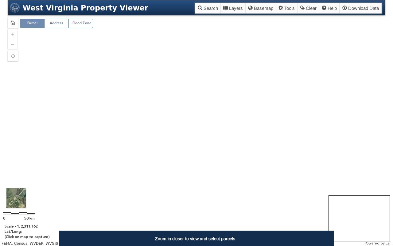
The captured statewide interface is useful because it keeps parcel geometry distinct from address points and links each selected tract to more detailed assessment data.
Check Hurricane Owner Records
The WV Property Assessment search lets a researcher select Putnam County and search by owner, street name, full parcel ID, property class, or land use. Advanced fields include mailing address, deed book, page, legal description, building year, and flood hazard. A result can also link back to the Property Viewer.
Record the smallest useful set: parcel ID, physical address, owner name, legal description, and date accessed. Add a mailing address only if it helps distinguish owner occupancy from remote ownership. Trusts, estates, firms, and multiple owners can appear. None is a list of residents.
- Parcel
- A mapped unit of land identified by a county parcel number.
- Situs address
- The physical location assigned to the property.
- Mailing address
- The place where the assessor sends tax correspondence, which may differ from the situs.
- Legal description
- Recorded lot, block, boundary, or tract language used to identify the land.
Hurricane Voters Are a Limited Layer
West Virginia's public voter lookup asks for first name, last name, date of birth, and an anti-bot check. It returns status, party, districts, and polling-place details for a known person. It does not accept a street, ZIP code, or parcel, so it cannot enumerate a Hurricane block.
A separate county voter file may be inspected or requested under W. Va. Code §3-2-30. Available fields can include name, residence address, party, status, precinct or district, and voting information. Telephone, email, Social Security, and DMV identification numbers are excluded. The statute sets a one-cent-per-name rule and bars resale or reproduction for profit.
The official voter-file statute shows the public fields and restrictions captured below.
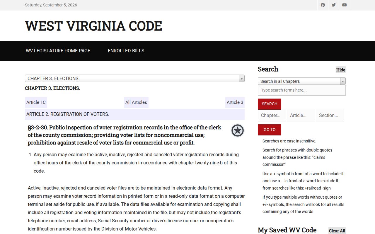
The law explains why a custodian request differs from the one-person web form and why protected identifiers never belong in a block directory.
Ask the Putnam County Clerk for the precinct or jurisdiction, desired public fields, file format, delivery, purpose, and current procedure. Protected-voter and Address Confidentiality Program records should be treated as redacted. Do not use surrounding parcels to infer a protected address.
The county elections office is also the fallback when a downloaded file, precinct label, or redaction is unclear. Preserve the request date and the custodian's description of the fields. Registration status can change, and precinct boundaries may not match a street segment or a parcel line. A non-match in the public name-and-birth-date tool is not evidence that a house is vacant.
Hurricane Community Contacts, Not Rosters
No verified municipal HOA list, subdivision association directory, block-council inventory, or public membership roster was found for Hurricane. The community layer is institutional. These contacts can identify public meetings, local-history sources, or group names, but they should not be presented as a household directory.
Neighborhood Watch
The city police page names the program but posts no roster, schedule, or geographic map. Follow the police page or call the non-emergency line at 304-562-9911.
Hurricane Public Library
The branch at 410 Midland Trail can provide local-history referrals. Call 304-562-6711 and ask about a named neighborhood, street, year, or civic organization.
City civic records
Council minutes, planning applications, and sign-in sheets may identify participation in a dated zoning or annexation matter. A participant's name does not establish residence.
Upper Vandalia lead
The historical society appears in local reporting and an older Blue Book, but no current official catalog or member directory was verified. Confirm contact before relying on it.
Compare Hurricane Neighbor Sources
Commercial neighbor tools often combine parcel data, address histories, marketing inputs, and public filings. They can repeat stale facts and hide the original date. Official records have narrower purposes, but each points back to a custodian and a defined field.
| Source type | Strength | Main limit |
|---|---|---|
| MapWV and assessment roll | Official parcel geometry and owner record | Does not list every occupant |
| County voter file | Statutory fields and custodian route | Not every resident registers; protected fields are withheld |
| City and civic records | Dated public participation and group leads | Not a household roster |
| Commercial compilation | May gather several leads quickly | Can be stale, incomplete, or detached from source dates |
Use a commercial result, if encountered, only as a clue. Confirm the parcel with MapWV, the owner with the assessor, a transfer with the Clerk, and voter information under the state rule. That sequence gives block research a clear audit trail.
When sources disagree, compare their effective dates before choosing one. The Sheriff's tax explanation says the owner, name, and address used for a tax bill are fixed on July 1 for the following tax year. A later sale can therefore make a deed newer than the assessment snapshot. Keep both dates instead of labeling one record wrong.
Hurricane Blocks Need Local Names
Historic searches may use Hurricane Bridge or Hurricane Station rather than the current city name. The railroad helped shift the settlement, and incorporation followed in 1888. Later growth along Route 34, Route 60, and Interstate 64 also means a mailing city, municipal line, and county parcel can describe related but different geography.
Local anchors sharpen a newspaper or minutes search. Hurricane City Park includes a retired C&O caboose moved there in 2016. Meeks Mountain Trails grew from a 2018 Hurricane Development Authority discussion and community work. Neither is a resident roll, but each supplies useful place terms for public meeting records, historical photographs, and Hurricane Breeze searches.
City Hall is on Teays Valley Road, while county property, election, and many court records route to Winfield. That city-county split is easy to miss. Check whether a block lies inside Hurricane before treating a missing city file as proof no county record exists, or the reverse.
Hurricane Neighbor Lookup Privacy
Parcel records do not reveal visitors, unlisted household members, or everyone who occupies a building. Utility customers, delivery data, DMV address records, sealed cases, and confidential vital details are not a public block directory. An address may also be absent by design.
West Virginia's Address Confidentiality Program gives qualifying survivors of domestic violence, sexual assault, stalking, or human trafficking a substitute address and mail forwarding. Enrollment lasts four years. State and local offices accept that substitute subject to program rules. Never try to work backward from adjacent parcels, voter data, or court filings to expose an actual residence.
Other statutes protect selected public officials and certain dependents or provide redaction paths for covered judicial and law-enforcement people. Recorded property documents can follow different rules because title records must remain usable. Ask the specific custodian what is public instead of assuming one privacy rule covers every file.
Lawful use. Research about a Hurricane block must remain respectful and personal. Never use public records to watch, intimidate, threaten, or harass anyone.